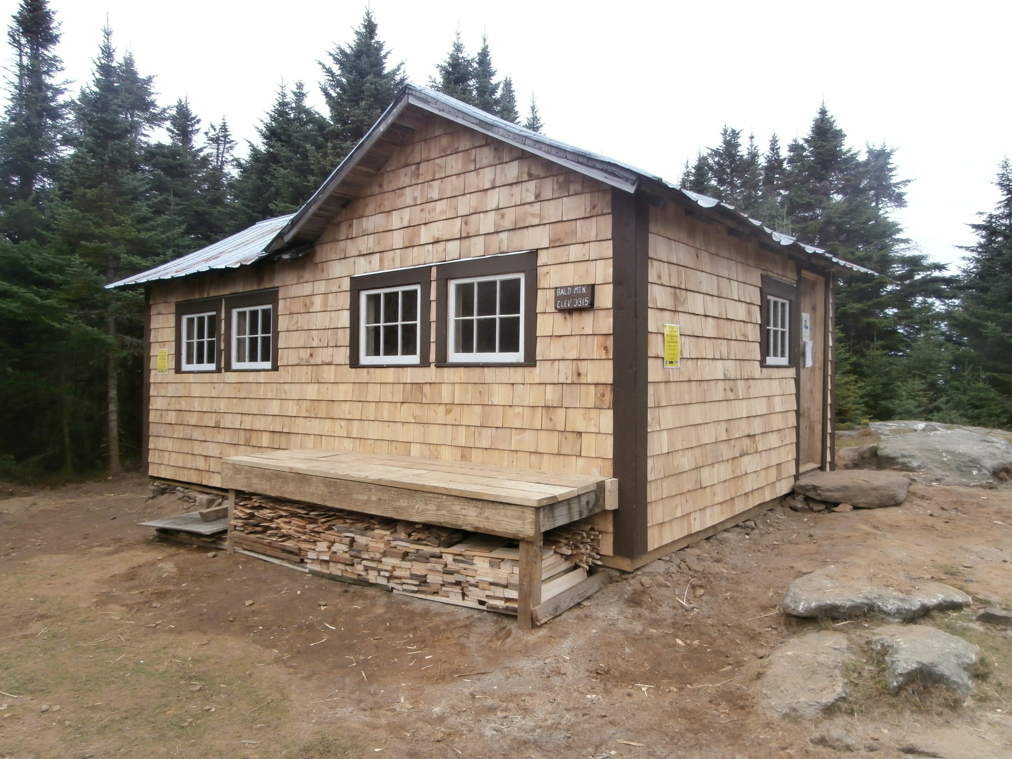
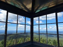
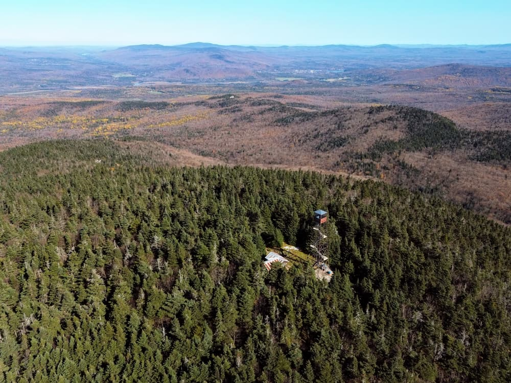
Located in the Town of Westmore, Bald Mountain is the third highest peak in the Northeast Kingdom and provides one of the best views of the region from its recently restored fire tower. The summit of Bald Mountain is accessed by three hiking trails: the Telegraph Trail, the Mad Brook Trail and the Long Pond Trail, although the Telegraph is seldom used and is in disrepair. The two most heavily used trails, the Mad Brook (north) and Long Pond (south) Trails, are maintained by the Westmore Association, the Northeast Kingdom Conservation Service Corps and volunteers with the Green Mountain Club. The recent acquisition by the State of Vermont of the summit property on Bald Mountain, including the Fire Lookout’s Cabin, Tower and much of the upper Mad Brook Trail, and its subsequent inclusion in the Willoughby State Forest led to significant restoration work on the Mad Brook and Long Pond Trails in recent years as well as the complete renovation of the historic summit fire tower.
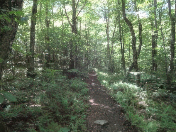
Bald Mountain, Long Pond Trail: Approaching the summit of Bald Mountain from the southwest, Long Pond Trail begins approximately 350-feet east of the Long Pond fishing access on Long Pond Road, 2 miles east of Vermont Route 5A. The blue-blazed trail leaves the parking area and follows a gated logging road, bearing right at a junction and climbing moderately to an open log landing. After it leaves the far right corner of the log landing the trail soon turns left into the woods where it again follows an old woods trail for a short distance before turning eastward onto a well-worn path. The trail continues through open hardwoods, crossing some small streams and then climbing more steadily into the subalpine spruce-fir forest. After climbing several steep pitches and passing some rock outcroppings the trail soon emerges on the mountain summit. SUMMARY: Road to summit, approx. 2.1 mi.; 1250 ft. ascent; 2 1/2 hr. (Rev. 1 1/4 hr.).
Bald Mountain, Mad Brook Trail: This trail approaches the summit of Bald Mountain from the north, beginning at the gated terminus of the Mad Brook Road in East Charleston. A small parking area nearby provides space for only a limited number of vehicles but hikers should keep the gated road and the neighboring driveway clear. The trail follows the graveled drive beyond the gate for roughly 1/2 mile before passing a private home and entering an open meadow. Continuing straight through the meadow the trail soon enters a mixed forest where it follows an open woods road, climbing easily and then turning west where it briefly descends to the base of Bald Mountain and the first of two nearby stream crossings. From here the trail climbs gradually around a large switchback and then more steeply up the mountain. Frequent examples of recent trail work are evident for the next mile. SUMMARY: Road to summit, approx. 3.0 mi.; 1415 ft. ascent; 2 3/4 hr. (Rev. 11/2 hr.).
Westmore, VT
https://www.trailfinder.info/trails/trail/bald-mountain-trails